We had a bus drop off at a place called "The Divide" which is about an hour out of Te Anau toward Milford Sound. This is the start of the Routeburn Track from the west - most brochures from the Department of Conservation describe the track walking from the Queenstown side. In the map below, "The Divide" is at the bottom left hand side.
 |
| Routeburn Track Map |
In summary, we spent the first night at Lake Mackenzie Hut, then 2 nights at Routeburn Falls Hut and then got picked up at the Routeburn Shelter by bus. Its about 30km from "The Divide" to Routeburn Shelter.
We left Te Anau at 8.30 on the bus and were dropped at "The Divide" at about 9.30am. It is well named as it is where the road passes out of the valley of Lake Fergus and climbs up over the saddle into the Hollyford River valley. Packs were all loaded after our stay in Te Anau and so we set off in pretty good weather and about 12 degrees.
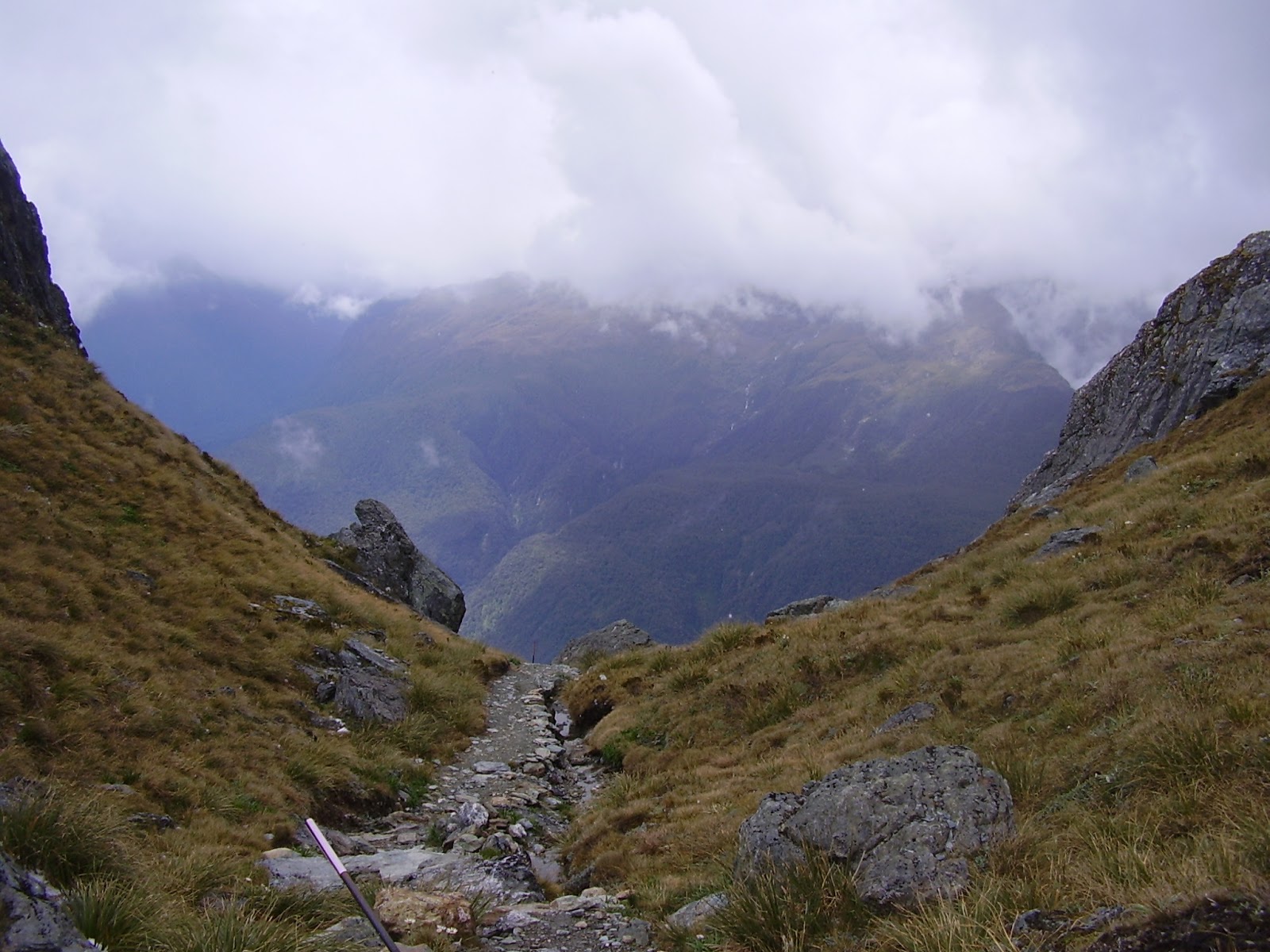
It took us about an hour (its uphill but not as steep as the first part of the Kepler Track) to walk to the turnoff to Key Summit - this is the top of the ridge separating Lake Fergus from Lake Howden. We left our packs at the track turnoff and walked up to the top (about 20 minutes). There is a toilet about half way up in the middle of nowhere! We are so impressed with the National Parks people and the services provided in New Zealand.
 |
| Toilet on Key Summit lower slope - the cable tie-downs stop it being blown away (from the inside or the outside!) |
The view from Key Summit is great and we were very lucky to have a clear day.
 |
| Key Summit view - looking north west over the Hollyford River Valley |
 |
| Flying on the summit of Key Summit |
Walked back down and donned the packs and walked on down the hill to Lake Howden Hut (only about 20 minutes) - this would be a good spot to stay overnight before setting out on the Greenstone Track or the Caples Tracks - both of which head down different valleys and you can be picked up over towards Queenstown. It was only about lunchtime as we headed along the side of the the Hollyford River Valley at about the height of the tree line. The forests here were exactly like the Ent forests shown in the "Lord of the Rings" movie with very long moss and lichen beards hanging off them.
 |
| Tree line between Howden Hut and Earland Falls. |
About an hour after Howden Hut, Earland Falls cuts across the track off the Ailsa Mountains to the east. Plenty of water all along the track by the way - no need to carry any water here.
 |
| Earland Falls |
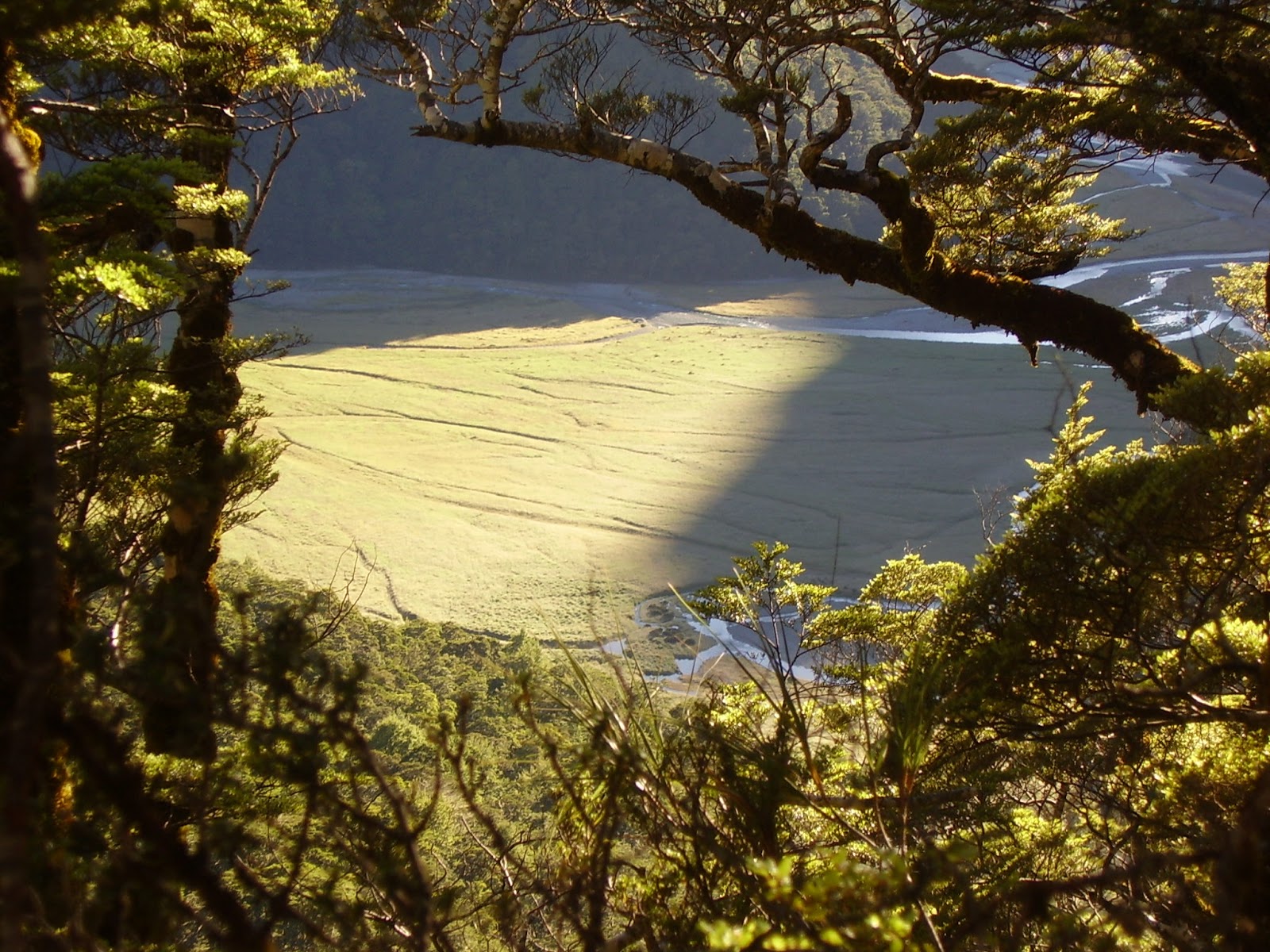
Great views all the way along this part of the track - you can see down into Gunn's Camp in the Hollyford Valley as well as the full length of the valley - this was the route of the indigenous people at some earlier time coming looking for the Greenstone most prized as a precious stone. We were very lucky with the weather compared to last week - sunshine and blue skies - wow!
About an hour after Earland Falls, we reached Lake Mackenzie Hut - our stop for the night. The track got very rough towards the end as it descended for the last kilometre or so down some large rock steps. The Hut was a welcome sight and the sunshine lasted until sundown at nearly 10pm making for some great light for photography.
 |
| Lake Mackenzie Hut |
 |
| From the Lake Mackenzie Hut verandah |
 |
| Reflections on Lake Mackenzie |
 |
| Looking across Lake Mackenzie from the Hut |
Went with the kids for a swim and a wash in the lake - it was very cold - I reckon about 8 degrees but OK to wash the vitals after a long day's walk. Dinner was another powdered something or other - they are all starting to taste the same. The ranger here was excellent - told us all about the stoats and the work being done to eradicate them. They not only eat bird's eggs but the birds themselves - the mountains here are bereft of wildlife as a result.
 |
| A stoat trap - these are everywhere along the track |
 |
| Stoats were imported to kill rabbits but liked birdlife better. |
Slept really well and were off by about 8am next day with a climb out of the valley where the lake sits providing some great views of the Hut and Lake from a distance.
 |
| Lake Mackenzie Hut from the climb out towards Routeburn Falls |
About 3 hours out from Lake Mackenzie Hut, we reached Harris Saddle - the point at which we climb out of the Hollyford Valley and over into the Routeburn Valley.
 |
| View over the Hollyford Valley and Gunn's Camp |
There is an emergency shelter here - well actually there are two - one for the plebs like us who carry all their gear with them and one for the high flyers who pay to have their gear helicoptered in for them and has morning tea and lunch provided in their hut for them.
 |
| Harris Saddle Huts - toilet in white, plebs shelter and then paid shelter to the left. |
We passed the turnoff here to the Conical Hill summit (we would come back tomorrow) as the weather was closing in a little and the Routeburn Falls Hut was still another hour or two away. The scenery from Harris Saddle onwards is stunning with snowcapped peaks all around and perched lakes and ribbons of water courses.
 |
| Harris Lake near Harris Saddle - you can see the Routeburn Track on the way toward the Hut. |
 |
| Mountains near Harris Lake |
 |
| The track above Harris Lake looking back toward Harris Saddle |
 |
| Looking down the Routeburn Valley from Harris Lake |
Walking down from the Harris Saddle to the Routeburn Falls Hut took about an hour or so with the views shown above all the way down. It started to rain on the way which made a bit slippery in parts. The Hut is similarly outfitted to the others but interesting that now that we were in the Mt Aspiring National Park instead of the Fjordland National Park (boundary at Harris Saddle), the role of the Ranger was different - less track maintenance and more Hut maintenance - and the Hut was very clean.
We spent two nights here. The weather forecasts here are about as accurate as at home ie. no one can predict the weather! There was heavy rain forecast for the next 2 days but we woke next day to sunshine so we walked back up to Harris Saddle to tackle the Conical Hill Summit walk. In the space of the time we were away from the Hut, we had sunshine, rain, snow and high winds and all at different times and the temperature didn't really change from about 5-6 degrees - what a stunning place!
 |
| Route Burn |
 |
| Routeburn Falls |
 |
| Weather forecast for the walk to Harris Saddle and Conical Hill Summit |
 |
| View off the Conical Hill above Harris Saddle |
 |
| Looking at Martins Bay in the distance on the west coast from the top of the Conical Hill Summit |
 |
| Elevation of Conical Hill Summit |
 |
| Sign at Routeburn Falls Hut |
After the second night we wandered off the next morning to the bus pickup at the Routeburn Shelter about 4-5 hours away. This took us down the Route Burn past the Routeburn Flats Hut and through some beautiful forests - a very pretty and easy walk with some sunshine weather and crystal clear water - can't complain about that. Can complain about the sandflys arriving again though from Routeburn Flats Hut onwards.
 |
| Routeburn Flats from Routeburn Hut verandah |
 |
| Routeburn Flats Hut - about an hour down from the Falls Hut |
 |
| Routeburn Flats |
 |
| Routeburn Flats and valley |
 |
| Schist near the Routeburn Shelter |
 |
| Tania on one of the many swing bridges towards Routeburn Shelter |
 |
| Routeburn Shelter - track ends here and the road home begins |
 |
| Route Burn water |


No comments:
Post a Comment