Search This Blog

Wednesday 20 February 2013

New Zealand Great Walks - Routeburn Track

We had a bus drop off at a place called "The Divide" which is about an hour out of Te Anau toward Milford Sound. This is the start of the Routeburn Track from the west - most brochures from the Department of Conservation describe the track walking from the Queenstown side. In the map below, "The Divide" is at the bottom left hand side.

Routeburn Track Map
In summary, we spent the first night at Lake Mackenzie Hut, then 2 nights at Routeburn Falls Hut and then got picked up at the Routeburn Shelter by bus. Its about 30km from "The Divide" to Routeburn Shelter.

We left Te Anau at 8.30 on the bus and were dropped at "The Divide" at about 9.30am. It is well named as it is where the road passes out of the valley of Lake Fergus and climbs up over the saddle into the Hollyford River valley. Packs were all loaded after our stay in Te Anau and so we set off in pretty good weather and about 12 degrees.

It took us about an hour (its uphill but not as steep as the first part of the Kepler Track) to walk to the turnoff to Key Summit - this is the top of the ridge separating Lake Fergus from Lake Howden. We left our packs at the track turnoff and walked up to the top (about 20 minutes). There is a toilet about half way up in the middle of nowhere! We are so impressed with the National Parks people and the services provided in New Zealand.

Toilet on Key Summit lower slope - the cable tie-downs stop it being blown away (from the inside or the outside!)

The view from Key Summit is great and we were very lucky to have a clear day.

Key Summit view - looking north west over the Hollyford River Valley

Flying on the summit of Key Summit

Walked back down and donned the packs and walked on down the hill to Lake Howden Hut (only about 20 minutes) - this would be a good spot to stay overnight before setting out on the Greenstone Track or the Caples Tracks - both of which head down different valleys and you can be picked up over towards Queenstown. It was only about lunchtime as we headed along the side of the the Hollyford River Valley at about the height of the tree line. The forests here were exactly like the Ent forests shown in the "Lord of the Rings" movie with very long moss and lichen beards hanging off them.

Tree line between Howden Hut and Earland Falls.

About an hour after Howden Hut, Earland Falls cuts across the track off the Ailsa Mountains to the east. Plenty of water all along the track by the way - no need to carry any water here.

Earland Falls

Great views all the way along this part of the track - you can see down into Gunn's Camp in the Hollyford Valley as well as the full length of the valley - this was the route of the indigenous people at some earlier time coming looking for the Greenstone most prized as a precious stone. We were very lucky with the weather compared to last week - sunshine and blue skies - wow!

About an hour after Earland Falls, we reached Lake Mackenzie Hut - our stop for the night. The track got very rough towards the end as it descended for the last kilometre or so down some large rock steps. The Hut was a welcome sight and the sunshine lasted until sundown at nearly 10pm making for some great light for photography.

Lake Mackenzie Hut

From the Lake Mackenzie Hut verandah


Reflections on Lake Mackenzie

Looking across Lake Mackenzie from the Hut

Went with the kids for a swim and a wash in the lake - it was very cold - I reckon about 8 degrees but OK to wash the vitals after a long day's walk. Dinner was another powdered something or other - they are all starting to taste the same. The ranger here was excellent - told us all about the stoats and the work being done to eradicate them. They not only eat bird's eggs but the birds themselves - the mountains here are bereft of wildlife as a result.

A stoat trap - these are everywhere along the track

Stoats were imported to kill rabbits but liked birdlife better.

Slept really well and were off by about 8am next day with a climb out of the valley where the lake sits providing some great views of the Hut and Lake from a distance.

Lake Mackenzie Hut from the climb out towards Routeburn Falls

About 3 hours out from Lake Mackenzie Hut, we reached Harris Saddle - the point at which we climb out of the Hollyford Valley and over into the Routeburn Valley.

View over the Hollyford Valley and Gunn's Camp


There is an emergency shelter here - well actually there are two - one for the plebs like us who carry all their gear with them and one for the high flyers who pay to have their gear helicoptered in for them and has morning tea and lunch provided in their hut for them.

Harris Saddle Huts - toilet in white, plebs shelter and then paid shelter to the left.

We passed the turnoff here to the Conical Hill summit (we would come back tomorrow) as the weather was closing in a little and the Routeburn Falls Hut was still another hour or two away. The scenery from Harris Saddle onwards is stunning with snowcapped peaks all around and perched lakes and ribbons of water courses.

Harris Lake near Harris Saddle - you can see the Routeburn Track on the way toward the Hut.

Mountains near Harris Lake

The track above Harris Lake looking back toward Harris Saddle
Looking down the Routeburn Valley from Harris Lake


Walking down from the Harris Saddle to the Routeburn Falls Hut took about an hour or so with the views shown above all the way down. It started to rain on the way which made a bit slippery in parts. The Hut is similarly outfitted to the others but interesting that now that we were in the Mt Aspiring National Park instead of the Fjordland National Park (boundary at Harris Saddle), the role of the Ranger was different - less track maintenance and more Hut maintenance - and the Hut was very clean.
We spent two nights here. The weather forecasts here are about as accurate as at home ie. no one can predict the weather! There was heavy rain forecast for the next 2 days but we woke next day to sunshine so we walked back up to Harris Saddle to tackle the Conical Hill Summit walk. In the space of the time we were away from the Hut, we had sunshine, rain, snow and high winds and all at different times and the temperature didn't really change from about 5-6 degrees - what a stunning place!


Route Burn

Routeburn Falls

Weather forecast for the walk to Harris Saddle and Conical Hill Summit

View off the Conical Hill above Harris Saddle

Looking at Martins Bay in the distance on the west coast from the top of the Conical Hill Summit


Elevation of Conical Hill Summit

Sign at Routeburn Falls Hut

After the second night we wandered off the next morning to the bus pickup at the Routeburn Shelter about 4-5 hours away. This took us down the Route Burn past the Routeburn Flats Hut and through some beautiful forests - a very pretty and easy walk with some sunshine weather and crystal clear water - can't complain about that. Can complain about the sandflys arriving again though from Routeburn Flats Hut onwards.

Routeburn Flats from Routeburn Hut verandah

Routeburn Flats Hut - about an hour down from the Falls Hut

Routeburn Flats

Routeburn Flats and valley

Schist near the Routeburn Shelter

Tania on one of the many swing bridges towards Routeburn Shelter

Routeburn Shelter - track ends here and the road home begins
Route Burn water

Tuesday 5 February 2013

Milford Sound and kayaking

After the bus pickup from Rainbow Reach on the Friday morning, we were whisked away by Ray (bus-driver) from Fjordland Tours and spent the rest of the day travelling the 117 km up to Milford Sound. Its worth taking the time as its a beautiful trip.

Tania at Knobs Flat looking toward Homer Saddle

The NZ parrot is called a Kea - very inquisitive and friendly

Marion Gorge waters near Homer Saddle
At Homer Saddle waiting for the tunnel lights to go green

Looking down into Milford Sound past the tunnel at Homer Saddle.

Well as you will realise, the rain certainly set in on Friday afternoon and ended with a storm about 9am Saturday. We stayed at Milford Lodge which was an excellent stay - a bar included! Dinner at the pub in Milford village was great as well.

The storm ended on Saturday morning but stayed raining while we went out kayaking on the Sound - this would have been spectacular on a clear day but all we got was heavy squally rain, high winds causing waves/swells and, even in those conditions, I got eaten alive by the sandflies - looked like I had measles! The kayaking people were great though and very professional.

Got whisked by Ray back into Te Anau on Saturday to the Youth Hostel again for two nights - washing (laundromats at the hostel and in town), stocking up for the Routeburn walk, and resting generally. I can't recommend staying in Te Anau enough - friendly people and great shops open 7 days and long hours. We were two nights at the Youth Hostel (Saturday and Sunday nights) - BBQ the first night and some soup and bread rolls from the bakery the second night.


Friday 1 February 2013

New Zealand Great Walks - Kepler Track

We spent nearly two weeks in Fjordland and Mt Aspiring National Parks in January walking the Kepler and the Routeburn Tracks with some R and R in between at Milford Sound, Te Anau and Queenstown. A fantastic trip taking 28 teenagers on a Duke of Edinburgh excursion - great kids, good company and great scenery. Some details below.

Gear

We both had packs - mine is nearly 30 years old but still in good nick (55 litre Macpac) and Tania's is relatively new (45 litre) from Summit Gear in Katoomba. Tania's was waterproof but I wasn't confident about mine so I added an Osprey rain cover to make sure ($30 from Paddy Pallin) - turned out the pack was OK but the cover was good to keep it a bit cleaner anyway.
Whatever we took, we had to carry for the duration so we packed pretty sparingly - down sleeping bag, liner, 2 sets of walking clothes (light nylon pants and merino T-shirt for me) and one other night set, 3 pairs of merino socks, merino jocks (Tania 2 and me 1!), fleece, rain jacket and pants, head buff/hat, sunnies, KFS cutlery (take a sharp knife next time), bowl, cup, Trangia stove, toiletries, camera, phone (with a book or two loaded on for reading at night). Airport weigh-in was about 10kg each pack with only food to add when we got to Te Anau. Everything went inside a series of Gladbags compressed and sealed and we took lots spares and a few good quality Glad garbage size bags as well - one of which we used as a pack liner.
I had my Culman camera bag as hand luggage - passports, pen, wallet, camera, phone, headphones, phone-charger. Tania took a rolled day-pack with her stuff which worked well as a shopping bag etc as well. We'd need a better quality one next time as it had self-destructed by the end of this trip.
Boots we already had - Raichle Goretex - and these were excellent. The only other footwear we took was Crocs (Tania) and Keen sandals.

Where we went - Kepler Track

Flew with Air New Zealand direct to Queenstown (about 3 hours) - great little international airport with only a main runway and no taxiing roads ie. the planes land, taxi and takeoff all on the same strip of bitumen. Picked up by bus and taken direct to Te Anau - 171 km and took a couple of hours along Lake Wakatipu and then farmlands through to Te Anau - very green and sunny and about 18 degrees.
Checked into the Youth Hostel on Mokonui St - great place and cheap. We had already booked our Hut stays on the Kepler and Routeburn tracks some 6 months previously and paid $54 per adult/night and all the kids under 18 were free.
Te Anau is a fantastic place to prepare for the walks. The supermarkets are geared up trekking-food-wise - lots of dried meals and fruit/nuts etc - especially the "Fresh" Supermarket on Milford Crescent and open 7am until 9pm 7 days. In fact all the shops in town were open very long hours and we stocked up on food and a new fleece for me from H and J's. The food we took for the Kepler walk of 4 days and 3 nights was:

Food for Kepler Track
The weather predictions were for very heavy rain and storms for the next day when we were due to start and they were right. It rained pretty much non-stop for the next 3 days - the place doesn't get to look so nice and green without lots of rain. In fact, the Fjordland National Park area on the west coast where we were gets an average of 6 and a half metres of rain a year - yes - that's not a misprint - that is 10 times Sydney's average annual rainfall.
The track map is below:


Kepler Track - we landed at Dock Bay and went anticlockwise on the red dotted line, though I couldn't find the red line on the ground!


We water-taxied over Lake Te Anau to Dock Bay - we were supposed to go to Brod Bay (as per the map) but apparently the jetty was already under water so we had a beach landing at Dock Bay. We had noticed the water level was up a bit before we left Te Anau:

Lake Te Anau - the clouded-in mountain to the upper right is where we walked ie. Mt Luxmore
but we didn't know what we were in for.
Took about 5 hours to get to Luxmore Hut - 4 hours below the tree line in the rain and an hour above the tree line in a raging storm. I used a small umbrella, shorts and merino t-shirt while in the trees instead of the rain gear as it was pretty warm and humid and climbing steeply at times. But I quickly put it away above the tree line - what with the lightning, thunder, 80km/h wind and heavy rain - donned the rain gear and I was fine.
Night 1 at Luxmore hut was great with apparently great views though we didn't get to see too much. The track profile was simple enough too.

Kepler Track Profile
Luxmore Hut - the last bit of the track into the Hut

Looking into South Fjord from Luxmore Hut

Helicopter pad at Luxmore Hut
At Luxmore Hut

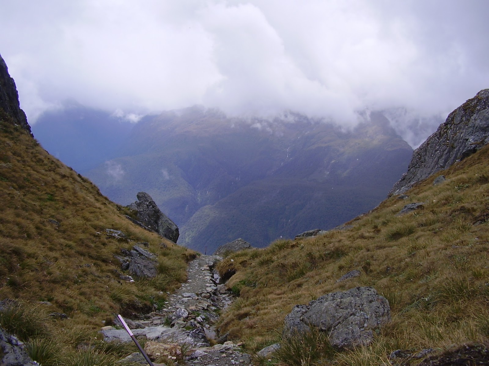
Day 2 was Luxmore Hut to Iris Burn Hut about 6 hours away. Stunning countryside on a fine day but we had rain, hail, 100km/h wind and landslides - it was still amazing to be walking out in such countryside with your own thoughts for company for 6 hours huddled inside your rain gear. We were about 1000m up so it was pretty cold as well though not sure of the temperature - certainly with the windchill it would have been below 0 all day across the top before descending into Iris Burn. One of the kids actually got blown off the track at one point as well - it was very exposed up there. The photos below don't really show the wind and hail but the countryside was fabulous.

From the track to Hanging Valley Shelter

You can see the track for a long way ahead...

and a long way behind.

Very steep off the ridge path to Hanging Valley Shelter.

The descent into Iris Burn Hut below the tree line was spiced with the track being cut in 4 places by a major landslip - the track's switchbacks were neatly dissected for up to 40 metres at a time making the track hard to find at times. Everyone was glad to get into Iris Burn Hut that night.

I took to having black coffee (took Moccona in a watertight plastic container) of a morning rather than black tea and had Pita bread with honey or Vegemite for breakfast. Tania had her usual porridge. Dinners were usually a "Back Country" dried meal ("serves 2") mixed with Uncle Ben's rice - very filling and fairly tasty and all cheaper to buy in NZ than Australia. The Outdoor Gourmet meals weren't bad either though a bit dearer. I have to admit though that after a few nights, no matter what freeze-dried meal we had, they started to taste pretty much the same. The rice we added and any spices you could take might make quite a difference. Lunch was usually had late after we made it into the Hut (mostly due to the weather being so bad - there was no where to stop without everything getting wet) about 3pm and was cracker bikkies, Vegemite and sliced Edam cheese. One packet of cheese and bikkies did the 4 lunches.

All the huts have running cold water into the kitchen and flush toilets as well. Gas cooktops are provided in the hut kitchen with tables and benches to sit. The bedding ranges from double decks of up to 14 mattresses all next to each other through to alcoves of 2 double bunks in a series. Vinyl mattresses are provided. Some huts have multiple bunk rooms and a wash room with a basin and cold water.

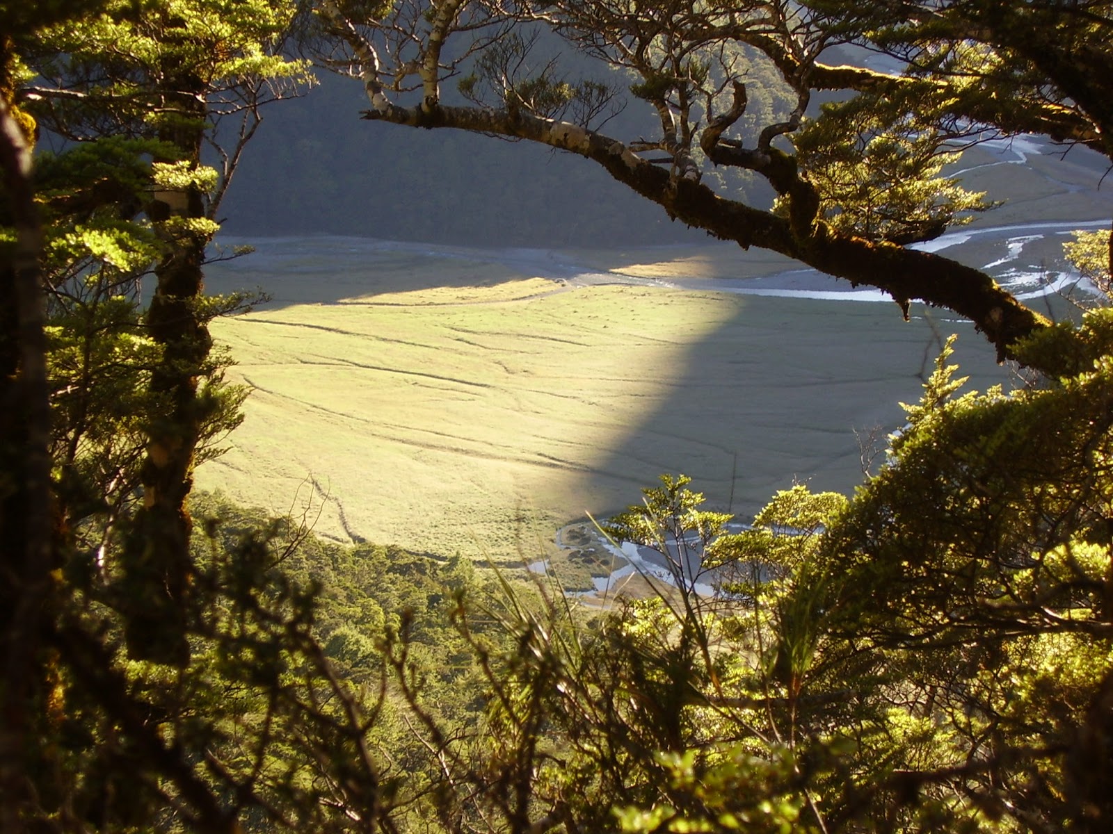
Iris Burn Hut to Motorau Hut was easy and very pretty walking along the Iris Burn - some serious flooding had been through there the day before (when we were up on top) but thankfully it had dropped by the time we came through, though in some spots the track was still covered by higher than boot high water for up to 10-20 metres of track. Some very big landslips again - the soil is only maybe half a metre deep and then its just rock. It rained most of the way and took about 5 hours or so. The Ranger (there is a resident Ranger at each Hut) was out track fixing all day and was dropped off by helicopter about 6pm. They do a Hut Talk each night at 7.30pm and collect the booking voucher - when you book online, you collect your booking voucher for each night from the Department of Conservation (DOC) office before you start the walk. There's one at Te Anau and one at Queenstown.

The days are so long in January - its beautiful twilight until about 9.30 or 10pm (when it's not raining mind you).

Motorau Hut on the Kepler Track - drying all the wet stuff.

View over Lake Manapouri from Motorau Hut

After Motorau Hut, it was only a couple of hours down to Rainbow Reach where we got picked up by the bus.

Tania on the last bridge over the river between Lake Te Anau and Lake Manapouri to get to the road.

Next up - on to Milford Sound.